Back in good ole IdaHOME!

Kaoha!  (hello!)

Well, that’s all folks.  I visited the gendarme again, filed a ‘crew change’ and I am officially checked off the island.  Tonight we will visit a restaurant, enjoy a tuna steak overlooking the sea and say goodbye to the Southern Cross.

Tomorrow, 6a, we grab the hilux and head out.  Hopefully that goes smoothly, we have given a good buffer of time.  My bags are already packed- absolutely crammed full with the electronics from this trip and a little bit of personal gear.  I won’t check a bag, so it should be easier to move through the many transitions in the next 48 hours of Toyota truck-plane-plane-plane-plane-Toyota truck.

The last few days have been great- we sailed into the harbor Friday in very rough sea and the night had been even rougher.  A great reminder that ‘it ain’t over till its over’ but also a fond reminder of what the passage was like.  Some good visits to neighboring coves and forests; a really enjoyable and down to earth culture.

Went to bed on the boat for the last time Friday night, looking out at the stars.  It was my last night with the surf, the sea, and all it holds.  The boat gently bobbing arround at anchor and the sounds of drums coming from shore.  How wonderful, and what a way to end the trip.  Little did I know that there was at least one more hurdle ahead- Wow what a road to the airport!

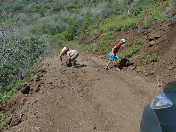
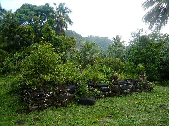
Rough driving, and on a clear day it was absolutely beautiful.   We stopped at ancient ruins and traced the shorline – 4WD (low) through mud, over rocks, sand, and arid dessert.  Amazing to see the ecology change, but I almost missed the plane!  It took about 4 hours- we had been told 2 to 2.5.

Checking back into Moscow life should be its own flavor of adventure, it will be good to see friends again and to talk with a little larger group than just Joseph and Mark!   It will be good, also, to feel the trip continue to develop within- and through- me.

Until next time,

Justin

Alright, end in sight!

Just around the bend from the harbor, is a small cove and village- Taipivai.  A few sailboats were anchored here, and we did too.  More scenic and quiet than the town harbor, this provided us a better place to rest and get ready to go.

We paddled to land here and walked around the community.  We got caught it a torrential downpour- which saved us from the ‘no-nos’, a biting insect.  We made our way through the rain and jungle, then up a small footpath that climbed 500 feet to a large tiki and cultural site.  This was an exceptional site, and we barely found the path concealed in the verdant growth pouring over the roads and clearings.  Needless to say, the sight of this area brought many unanswered questions to mind about the communities that used to – and perhaps still- use the site.

I read a great article about an expedition here in French Polynesia- check it out online.  www.tataexpeditions.org  Cool science!

Now we spend our time closing up shop, so to speak, on the boat.  The ship, and Mark, will remain here sailing until July.  As for Joseph and I, back to the northwest after leaving everything here ‘ship shape.’  We drive tomorrow overland to catch the plane- it looks to be a dramatic drive over edge of the volcanic mountains to the ‘desert’ side of the island where a small plane can actually land.

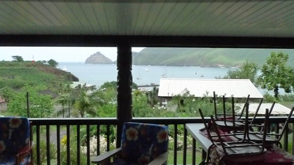
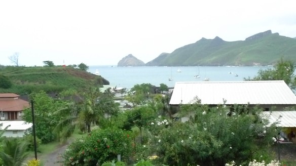
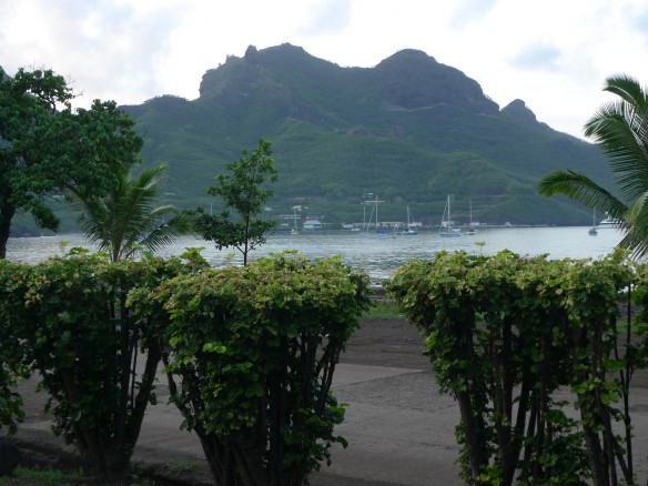
Some parting photos of the town, before we get in the HILUX and venture over the mountain top to find the airstrip.   I will post again when I hit the great northwest, and include the last of the photos and thoughts from this trip.

Concluding the last hours of my stay here, it is hard to keep track of all the memories, questions, feelings, hopes, and thoughts about this powerful place and the amazing journey here have imprinted on me in the last month.   Like most nights, I wrap up the day laying on the deck at the bow of the boat, looking up at the stars, and now the skyline of the island, taking in the sounds and smells of the ocean, the coast, and soaking in the adventure.  Sacred and mundane.

Look for more about the conclusion of the trip on Monday!

Biodiversity: Ocean Abundance

What is biodiversity?

Our planet hosts a staggering number of different life forms in an incredible array of different places.  Most of the organisms on our planet have similar needs to sustain their lives: oxygen, food, shelter.  They can survive best in habitats that provide for their needs on a regular basis; some organisms are able to survive in a wide range of environmental conditions, while others are only able to survive in very specific environmental conditions.  An ecosystem on land or water is made up of the different organisms that live there, the resources that are available, and the nonliving aspects of the environment.

In general, the variety of lifeforms increases from the poles to the Equator; there is a smaller number of different species near the poles, and there is a larger number of different species nearer the Equator.  This range of biodiversity is dependent upon the availability of environmental conditions and resources to sustain life.  Near the Equator, for example, there is an abundance of solar radiation and rainfall throughout the year, providing for a richer diversity of life than that found at the South Pole.  Local and regional conditions provide a variety of physical habitats within which organisms can thrive and survive across time; when environmental conditions of habitats change, the diversity of life may also change.

Let’s consider the areas around mountains in the Pacific Northwest.  Many of these mountains are volcanic in origin, but are also influenced by significant rainfall and snowfall, and many have even been influenced by the presence of glaciers.  Sun, rain, and freeze-thaw processes break apart the rock and form soil.  As the soils weather, they release mineral nutrients into the environment.  Plants are able to take root in the soils, absorb the nutrients, rainfall, and sunlight, and grow as they produce starches, sugars, and other substances.  Plants are known as producers within an ecosystem.  Some organisms subsist on plants, eating bark, leaves, stems, and even roots; these are known has herbivores or primary consumers.  Other organisms subsist on the herbivores; carnivores engage in hunting or scavenging the herbivores, and are known as secondary consumers.  Organisms that subsist on plants or animals are known as omnivores.  In the mountains, a Ponderosa Pine tree is a primary producer, an infestation of Mountain Pine Beetles feeding on the tree are primary consumers or herbivores, a Three-toed Woodpecker that preys on beetle larvae and seeds is an omnivore, and the Coyote that consumes a woodpecker is a carnivore.

In the oceans, nutrients are often dissolved in the water and can be flushed off the continents and islands into the water surrounding those bodies of land.  Sunlight in the ocean is used by plants that affix themselves to the shoreline, rocks exposed at low tide, and other features of the near shore environment that have a fairly reliable nutrient supply.  Plants are also found floating near the water’s surface; microscopic plants that float freely are known as phytoplankton.  Where there is an abundance of phytoplankton, many other life forms exist that subsist on the plants (herbivores) or subsist on other animals (carnivores), but there aren’t as many that consume both (omnivores).  Off the coast of the Baja Peninsula in Mexico, sunlight and nutrients in the water support the growth of phytoplankton (producer), which is eaten by microscopic animals known as zooplankton (consumers).  Pacific sardines eat zookplankton (carnivores) and in turn are eaten by Pacific tuna (carnivores), and both are eaten by humans (omnivores) after being caught by nets or hook and line fishing.

The greater the number of connections between predators, prey, and consumers in an environment means that there is a corresponding greater the level of biodiversity within that environment.  Greater biodiversity within an environment makes the environment more resilient to catastrophic change, such as natural disasters, since it is then more likely that some organisms will survive a volcanic eruption, an oil spill, etc.  Lower biodiversity makes it more likely that natural disasters can wipe out local and even regional populations of a species.

A 5 star day

Well, if there were a contest for best day of the trip- this would sure be at the top.  We paddled ashore and tied up the kayaks at the base of some coco trees.  Here, a river met the ocean and a couple of kids were playing in the brackish water there.  From here, we walked up to a cluster of houses and then on up a path headed towards the valley.  Land crabs were everywhere!  They dig holes all over, and are lurking around until they see you, after which they dart to the nearest hole.

The people we met were very kind and generous- putting up with our very bad and broken French language skills.   Many of them were tending gardens and farm plots- we saw pamplemousse, pineapple, coconut, banana, peppers, mango, papaya and more.  We bought some fruit for the hike from a couple living up this path; very generous exchange even though we couldn’t really communicate with words.

Headed up the valley further, we continued on a 3.5 hour hike that wove its way through the forest along an ancient roadway.  We could see in the shadows and under the lush vegetation the remains of many, many homes.  Some of the books say that as many as 2000 people lived in this section alone.

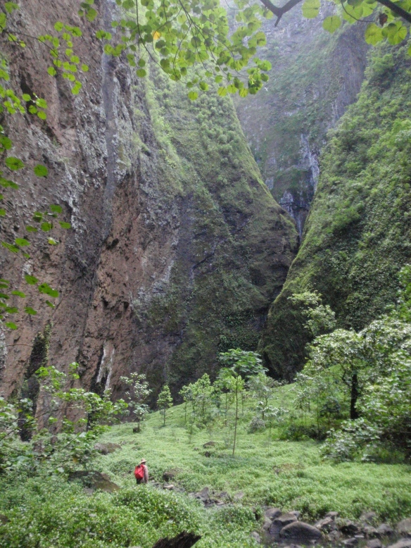
Finally we reached an improbably steep canyon, lush with vegetation and it had tropic birds circling high in the sky.  We continue on, watching for rock fall, and end up at the dead end of the canyon- a 1300 foot tall waterfall.  We, of course, go swimming in it!  To get all the way back, we swam under a huge boulder that had fallen—then on the other side the raging torrent of cold water was coming directly down on us.  Over millennia it had carved a huge cavern in the basalt rock, leaving a cathedral of stone flanking the falls on both sides.  Wonderful.
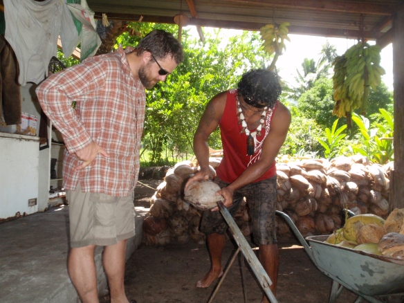
On the hike back, we stopped by another home and met Tiekee, who gave me a lesson on how to husk coconuts.  He said he had husked 500 that day!  I think I need more practice.   He wanted to trade me hats and sunglasses- but I managed to trade for the Vandal flag I had brought instead!

Later we met him again with fish he had speared.  Among the biggest was the parrot fish. He took a small boat out and with fins and a spear dove to catch these fish.  Pretty impressive!

Finally, I had a chance to talk to some students from Lapwai, back home in Idaho.  Good to hear some voices from home!  Thanks everyone for the great questions!

Islands: Global Climate Change

What major impact might climate change have on islands?

Climate change is a topic often headlining news stories in print, radio, television, and on-line news media sources.  Scientists and research institutes publish scholarly articles and papers on many different aspects of the topic.  Commentators publish opinions on all sides of the topic.  The general public often scratches its head and wonders which voices they should listen to, and what to believe about climate change.

Scientists who study the planet’s climate system focus on many of the different components of the system, and try to understand how the parts of the system function, how they work together (or in opposition), and what the impacts of a shifting climate are predicted to be.  They can also study the events that happen right in front of their eyes.  Glaciers advance and retreat, wind patterns weaken and reverse, drought afflicts one side of a mountain range while flooding occurs on the other side, and some planted crops provide record harvests while others wither and wilt.

Oceanic islands provide interesting natural laboratories for science.  The landscapes and the ecology of islands can be quite sensitive to a shifting climate.  If the local and regional temperatures get too high or too low, it can influence growth cycles for plants and plankton, which can cascade through the food web as populations skyrocket or crash.  If the local and regional rainfall decreases, fewer nutrients may wash into the ocean off the islands, resulting in slower growth rates within the ecosystem, but also slower rates of island erosion.  Conversely, increasing rainfall may enhance growth rates in the ecosystem with an influx of nutrients at the cost of increasing the erosion rate, loss of topsoil, and possible damage to terrestrial ecosystems on islands.

Another potential impact on oceanic islands related to climate change is how the oceans react to a warming or cooling climate.  On a global scale, a cooling climatic trend would result in more precipitation falling on the continents (especially at high latitudes and high elevations) in the form of snow rather than rain.  In a cooling climate, snow will accumulate year after year, slowly changing into ice and building large storehouses of frozen water that we call glaciers.  In a cooling climate that develops into an Ice Age, global sea level can actually drop as more and more water is literally frozen in place on the continents and the polar ice caps, and therefore not in the global oceans.  During the last major Ice Age, about 20,000 years ago, global sea levels were as much as 120 meters (~360 feet) lower than mean sea level today.  An image depicting this sea level for part of northern Europe is shown just below.

So what happens if the global climate isn’t cooling, but is warming?  Again, thinking about global climatic patterns, a warming climate might generally mean less precipitation falling as snow and more falling in liquid form as rain.  More rainfall instead of snowfall, and warmer temperatures, could mean that glaciers would be retreating instead of advancing.  The global storehouses of frozen water would gradually melt as warmer air temperatures and relatively warmer rain help to melt the glaciers in the mountains and ice sheets and caps near the poles.  Instead of being stored in frozen form, more of the global water supply would runoff into the ocean basins.  More water in the oceans would give way to sea level rise.  Additionally, warmer conditions on the planet would cause the global oceans to warm up… and water expands as it warms up… leading to even more sea level rise.  Near the extreme end of current climate change projections, sea levels could potentially rise as much as about 60 meters (~180 feet).  The image below shows the impact on the shoreline for the same region of northern Europe.
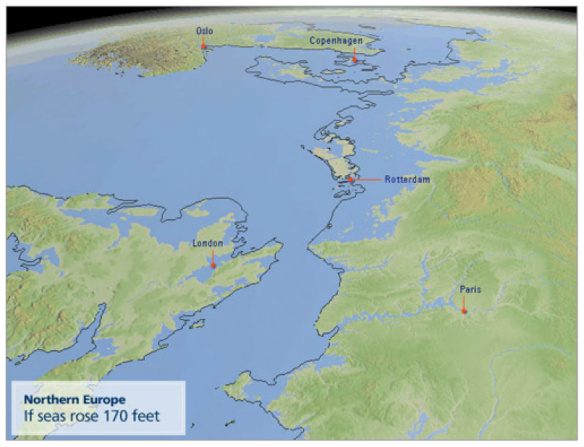
If this is a possible future for Europe, with its vast coastline and dependence on maritime travel and commerce, imagine… what might happen to oceanic islands?  Any amount of sea level rise would impact oceanic islands.  The tides and waves would reach higher onshore, eroding the nearshore zone to a much greater extent.  Low-lying areas would be inundated by salt water, including most of the towns and cities, which have historically been built on the flat, sandy areas near the bases of the volcanic mountains that form most oceanic islands.  Using the on-line Google Maps tools at http://flood.firetree.net/ by Alex Tingle, we can see what an extreme sea level rise would do to Nuku Hiva’s shorelines.  It wouldn’t completely submerge the island, but it would pinch off two peninsulas, creating two new islands, and it would completely submerge the towns on the island.

Is this science fiction?  The Alliance of Small Island States has 39 member nations around the world.  They are actively engaged in the scientific and political debates regarding climate change, sea level rise, and other threats to their maritime cultures and economies.  Even if extreme sea level rise does not occur, any significant sea level rise will have physical, cultural, and economic impacts on island nations.  Consider the Republic of the Marshall Islands, located in the Pacific Ocean at about 9 degrees North latitude and 168 degrees West longitude; the Republic is composed of 5 islands and 29 atolls whose average height above sea level is 6 ½ feet.  Sea level rise of even a single foot would be significant to this entire country.

In May of 2011, the Columbia Law School’s Center for Climate Change Law hosted a conference that addressed legal issues related to sea level change: “Threatened Island Nations: Legal Implications of Rising Seas and a Changing Climate”.  The people of island nations take sea level change seriously enough to start thinking about how to collect compensation from other nations who may be contributing climate change; this has been a consideration since at least the 1980’s.  An interesting side note to the legalities of climate change is that such legal action was a critical element of author Michael Crichton’s book State Of Fear, which is an action-adventure novel with a climate change plot.

Exploring a different island

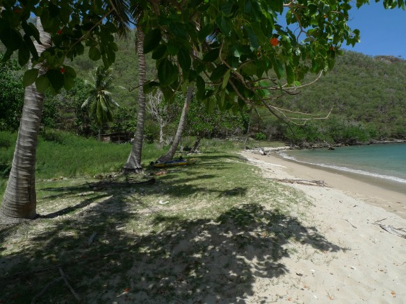
We have relocated to Hakatea, or Daniel’s Bay for a bit.  The large bay faces the sea, but there is a cove to the side that offers an entirely protected anchorage.  Here, we ‘drop the hook’ (lay anchor) and settle in.  After the boat is set, we inflated kayaks and paddled to shore.  Here there is an abandoned cabin, and some agricultural efforts gone to some degree of neglect.  There are coconuts, cows and horses though!  We drink some green coconut milk and walk around a bit, then I swam a lap between the boat and the beach.  Feels good to get moving!
Early in the morning, Mark and I took the kayaks around the edge of the bay.  Tremendous, some violent crashes of surf on the coast.  We explored some of the intertidal areas, and some sea caves.  Crossing the bay, a shark came up between us three times!  Something to think about for the next swim….

On the way back to the ship we became aware that we were paddling in the middle of a large group of Manta Rays.  Whoa!  These are huge, graceful creatures.  We watch them eat and glide around each other.  Some times you can see both of the ‘wing’ tips out at once- imagine a flying car hood for size…but more beautiful.

After seeing these, we rush back to grab the snorkeling equipment and Joseph.  We arrive back to the scene and jump in with fins, snorkels and hopes of seeing these graceful creatures more closely.  We are rewarded for our haste!  We swim with them for 15 minutes, watching them dive and meander.  One that was 2-3 meters from me turned over on its back and arched below me.  The topside of the ray is dark, but the bottom is white- allowing me to see its eyes, mouth and markings.  A real highlight and gift to see this in person and in such exceptional surroundings.

Back at the ship, I get ready for a hike over to the rugged cove to the east.  Mark and I begin together, picking our way through the bush to gain a ridgeline.  In the process, I cut my leg on some barbed wire pretty nicely.  Goes to show, keep your guard up!  We get to the top and then drop down, into a heavily grazed understory and follow an old stone path down down down.  We split up, Mark headed back and I down to descend a cliff down to the beach.  The beach itself was an enormous jumble of cobbles- head size and larger.  It made such a beautiful noise as the surging waves retreated back through this stony field.    Quite the contrast to the violent crashes as the sets come ashore.  I climb 10 meters down the cliff face to the tide pools full of fish, a thunderous blow hole filling and a rising tide.   What an incredible place this is!

Tomorrow, we’ll visit the village and waterfall, and hopefully get to meet some of the families that are here.

Islands: Geomorphology & Ecology

What happens after an island forms?

Once an island has formed, it is subject to many of the geomorphic processes that influence the continental landmasses, especially processes associated with coastlines and mountains.  Islands are also subject to interesting ecological processes as they slowly get populated and inhabited by different terrestrial and aquatic lifeforms.

So long as the volcanic activity that initially formed the island remains active, it can continue to grow or maintain its general shape fairly well.  Once the growth activity stops, the normal weathering and erosion processes that influence islands tend to reduce it over time; wave action pounds at the island’s shoreline, and rainfall weathers and washes sediments from the island’s mountain slopes.  In the diagram below, a progression of island forms is depicted from left to right.  At the leftmost position is shown a young oceanic island whose volcanic activity has ceased.  Moving to the right, the island visibly diminishes as time moves ever forward.  More of the island weathers and erodes and falls into the ocean as sediment, and the island is eventually worn away until it recedes below the ocean surface.  The lists below each picture are island names and locations that are in that particular “island stage”.

One of the major structures associated with oceanic islands are coral reefs, which tend to ring oceanic islands.  The structural coral is formed as exoskeletal calcium carbonate deposits that are created as protective housings by polyps (small marine animals) and their symbiotic photosynthetic algae.  Colonies of coral symbionts build a diverse range of exoskeletons on the submarine slopes of oceanic islands.  As the coral structures are broken by waves, predation, or the deaths of colonies, the materials build up on the island’s slope.  Over time, as the island is weathered away, or as the island subsides deeper into the water, the corals keep building the rings around the island.  Over millions of years, the islands may be weathered away to submarine nubs, but the corals may still be at or near the water surface.

Coral reefs not only provide structure and safety for the coral symbiont colonies, they also provide protection and habitat for many other marine plants and animals.  The ecology of coral reefs can be quite rich and diverse with many forms of life.  Many different coral species may inhabit and collectively build a coral reef, and many invertebrate and vertebrate marine species find food and shelter within the relative safety of the calcium carbonate forests that the corals build.  A shallow water atoll is the source of the reef scene below (courtesy of the Coral Reef Alliance).  The reef areas get populated by marine life that floats into the island environment on a current, or by organisms that swim there under their own power.

The terrestrial life forms that populate islands usually have to organisms that travel by air or water.  Sometimes they are migratory animals that literally get blown off course during a migration and settle on a convenient island.  Sometimes they are animals that get washed out to sea from the mainland during a storm, and cling to debris that manages to stay afloat long enough to reach an island.  Sometimes, animals are intentional or unintentional passengers on airplanes or boats that humans use to visit islands.  Plant seeds borne aloft on strong winds can be blown from continents to the middle of an ocean basin, and can colonize an island if they germinate in the soils and have sufficient nutrients and water to survive.  Depending on the resources available, some islands have greater biodiversity in their surrounding waters than on the land surface of the island.  Some islands are nothing more than bare rock or sand, while others look like a rainforest or grassland.  Others have areas that combine these different land cover types, especially the larger islands that are in turn larger mountains.

Island living

Among changes since we have been on land, it rains a lot more here.  At night, we have to get up and shut the portlights to keep rain from drenching the inside of the cabin.  On the other hand, this cools everything down and – more preciously- gets saltwater off of everything its become encrusted in over the last 4 weeks.  This is great, and really make things more comfortable.

Walking around town is a great experience, getting to walk at all is quite a pleasure.  The town is spread along the shoreline- no real ‘city center’ for the 1500 or so people that live here.  Historically, communities on the island were in the highlands.  After the colonial and maritime interests developed, town sites were more common by the sea.   This town is the capital for the Marquesas Islands.

Visiting town, I really don’t get the feeling there is much in the way of tourism or catering to visitors.  By all means, people are friendly, but what I mean to emphasize is the beautiful lack of coffee shops, souvenir stores, tourist attractions, signs, or storefronts, etc. that make it hard to see who lives here and how day to day life looks.  A wonderful first impression of the island.

We will sail west of here for a few days, exploring the coast and visiting smaller villages.  Hopefully, we will see more sealife, some of the forest, waterfalls, and ancient sites.

Islands: Formation of Islands

Where do islands come from?

When you live in a landlocked area, you might not often think about oceanic islands or their origins.  Where do they come from?  How are they formed?  Do they change over time?  In landlocked areas, you might have these questions about mountains, valleys, plains, forests, grasslands, and deserts… but probably not about islands unless you happen to take a trip to one.

Quite a few of the major geological features of the Pacific Northwest are related to volcanic activity.  Earthquakes in Seattle are often caused by tectonic plates sliding past one another just off the coast or even cracks in the planetary crust that are located under Puget Sound.  The majestic mountain ranges of the region are often volcanoes; some are more active than others, such as Mt. St. Helens and Mt. Rainier.  The Columbia Plateau was formed by volcanic vents that loosed flood basalts across the region between the Cascades and the Rockies.  The Snake River Plain was formed as North America pivoted over the top of a hot spot plume of magma that literally melted the landscape, creating cinder cones, Craters of the Moon, and Yellowstone.  The Pacific Northwest has a rich volcanic heritage, which is related to how many islands form around the world.

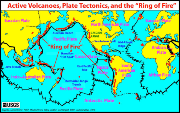
Islands are typically formed in areas where the planet’s rock crust is compromised in some way, which allows molten rock (magma) from the depths of the Earth to rise up to surface (lava), creating new rock material as it cools, crystallizes, and hardens into new geologic structures.  Along the coastlines of the Pacific Ocean are numerous locations where these processes occur, which give rise to the name, “Pacific Ring of Fire”, as many of these locations are mountain-building volcanoes.  Throughout the Pacific Ocean’s basin, there are locations far from continental coastlines where mountain-building processes also occur.  Think of these islands as the tips of mountains that are visible above sea level.

The Earth’s surface is broken up into large pieces often known as “plates”, which are in motion, driven by the flows and currents of magma from the Earth’s core.  As these plates slowly move, many of them collide, and their collisions are often associated with volcanic mountain-building.  When a dense, heavy oceanic plate collides with a less dense, lighter continental plate, the oceanic plate plunges underneath in a process known as subduction.  Friction and radioactivity melt the oceanic basaltic rocks and continental granitic rocks, forming magma.  The magma rises to the surface, pushing up the Earth’s crustal surface, creating mountains, and sometimes resulting in volcanic eruptions, as shown below.

Another type of plate convergence occurs when an oceanic plate collides with another oceanic plate.  Both plates are dense and heavy, and both are pulled downward towards the Earth’s core.  As they descend, however, similar friction and radioactivity processes melt the rock and create magma that rises toward the surface.  As the material emerges on the ocean floor, it cools and accumulates over time, building a mountainous structure upward to the ocean’s surface.  Just as the ocean-continent convergent plate boundaries are associated with mountain ranges that occur in curving arcs, the ocean-ocean convergent plate boundaries are associated with curving arcs of mountains… which we call islands, because they are surrounded by water.

A third type of mountain-building can occur far from a plate boundary, far from plate collisions.  There are stationary plumes of magma over which plates can move.  These stationary “hot spots” send relatively steady streams of magma to the surface, which melt through the rocks that comprise the plate, and build up cones of material.  In the middle of an ocean, these hot spots can build volcanic island chains.

These different mountain-building processes are part of a larger geologic field of interest known as “tectonics” or “plate tectonics”; the term ‘tectonics’ derives from the Latin word ‘tectonicus’, which translates into English as ‘building’.  Most oceanic islands, whether they are near continental coastlines or in the center of an ocean, are active volcanoes or remnant cones of dormant volcanoes.

Terra Firma

At last we land!  We saw first land around dinner time, but this was not the island we were after.

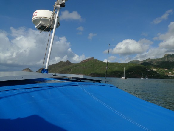
Further on, Nuku Hiva still waited and we sailed along its shore using the radar as well as the GPS.  Soon, we could see the glow of Taiohae and when it was insight, we were in between East and West Sentinel- the two islands that guard the harbor.  Coming into harbor brought sights and sounds we hadn’t heard in quite some time.  Wow.  The tide crashing on shore, town lights, wood smoke, and some other boats.  After some maneuvering we got the boat anchored and reflected on the journey.   Then, a late bed time.

In the morning, we were up early getting things settled around the boat-  also still in sailing mode we were taking advantage of the calm water to get things done.  We were to remain under the quarantine flag until we had cleared French customs.  Quarantine flag is run until you have been cleared to enter any country by boat.  The name is from an older era where keeping the sailors aboard had a greater impact on community health.  We, however, do not have smallpox!

We met our agent at the dock, and went in and cleared customs.  Following this, she took us around town to show us where key places were that we would need to get the ship set up, our flights arranged, and some transport we still needed to secure.

It is beautiful here, the harbor and town are very nice and we stretched our legs a bit walking around the shore front.  About 1500 people live here, and there is VERY little English spoken- in fact just one other person we met that day who moved here from the US.  Needless to say, it really feels like a shift in place, change in lifestyle and that we really are in another culture.

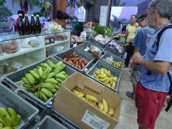
We got some supplies at the dock market- very fresh and a great introduction to what is grown – and eaten- here.

The open ocean crossing is behind us!  What a relief, and what a great feeling to be on land.  A lot to  reflect on as I get used to shore life again, and get things arranged for my return home.  During that time look for a few more posts from the island, and later once back in the States, posts from schools we will visit.

French Polynesia: The Setting

What is French Polynesia like?

The archipelagoes (island chains) that make up French Polynesia (also commonly called Tahiti, after one of its largest islands) can be found near 15 degrees South latitude and 140 degrees West longitude.  The region was annexed by France in the 19th century, during a global period of expansion and imperialism by many of the world’s major maritime powers.  The five major island groups are the Archipel Des Tuamotu, Iles Gambier, Iles Marquises (the Marquesas), Iles Tubuai, and the Society Islands.  All of the islands come from volcanic origins; some are younger, with steep slopes, cliffs, and gorges, while others are older, worn down atolls.  In total, the islands cover approximately 1,600 square miles of land area spread across many thousands of square miles of ocean surface.

Archaeological evidence suggests that French Polynesia was first colonized by humans approximately 2,000 years ago.  These early settlers probably came from island chains to the west, and brought with them a maritime culture.  Ethnographic fieldwork and excavations in the Marquesas revealed about 100 different fishing techniques used by the islander, indicating the importance of marine resources to these sea-faring folk.  This area is thought to be the source of the people who explored the seas and colonized Hawaii and New Zealand.  The native economy included terraced and irrigated agriculture, gathering uncultivated fruits, plant roots, and shellfish, and of course, subsistence fishing.

The various islands and archipelagoes were discovered by European explorers dating from the 1500’s up into the early 1800’s.  France established a protectorate on the island of Tahiti in 1842, and by 1880, had formally annexed the archipelagoes as the French Colony of Oceania.  The region later came to be known as the Overseas Lands of French Polynesia, and is more commonly known as French Polynesia in modern times.  Although the President of France is officially the head of state, French Polynesia has its own elected President, an Assembly of elected representatives, and an appointed Council of Ministers.  Both French and Polynesian are officially recognized languages.

In the 20th century, French Polynesia transformed from an agricultural and subsistence economy to a cash economy largely dependent upon military and tourist spending.  The French military utilized areas in French Polynesia for its weapons program, testing nuclear weapons on islands and atolls from the 1960’s to the late 1990’s.  Following the cessation of nuclear testing, tourism became a more important part of the regional economy, with the services sector of the economy accounting for more than 75% of the gross domestic production, and 68% of the regional labor force.  A major export of the region is the Tahitian black pearl, which accounted for $126 million in exported pearls in 2007.

It isn’t too difficult to see why tourists like to visit French Polynesia.  The photo below is of the island of Bora Bora, a relatively small island surrounded by beautiful lagoons and coral reefs, where the temperature is almost constant throughout the year.  Annual rainfall across the region ranges from 24 inches on smaller island to as much as 958 inches on the largest islands.  There are about 275,000 inhabitants of French Polynesia, and reportedly more than 250,000 tourists visit the region annually.

No land just yet…

Friday the 13th !

Here is a 360 degree pan of the ocean from the deck, a little rough, but for comparison this level of sea state and motion is in the better 20% that we see.

We were originally to arrive today, but will miss some connections now to flights etc.  The important thing is that we are safe, and will likely hit land tomorrow, meet our agent, and have the ship clear customs.   When our ship comes to harbor, we will be under the quarantine flag until we are officially entered.  A cool part of maritime law/history.

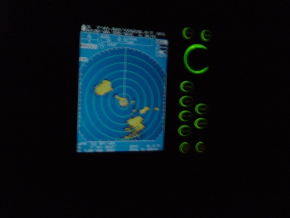
The squalls last night were pretty big!  I have included a few photos of the radar image- one I think accurately captures what it is like to wake up in the middle of a storm, throw on my PFD, and head up to see what the radar tells as our fate.

I have been looking more at the books aboard that cover the island we will stop on.  Funny that its taken me so long to get around to them!

Have a great weekend, look Monday for posts of our landing (hopefully!)

Trail Report Information

S 07 04.66

W 138 13.26

Barometer 1007

Cloud  68F  20%

Humidity 77%

Air temp 88F

Boat speed 6.5 knots @ 227 heading

Wind 14 knots, E

Water temp 81.3

Plankton count 1/64th mL

Climate: El Nino/Southern Oscillation

What is El Nino and the Southern Oscillation?

Every few years, we hear about El Nino or La Nina on the news, and for several months weather-related stories are linked to these odd names.  What does it mean when weather is dominated by “the boy” or “the girl” (translated from Spanish)?  Recall that climate is conceptualized as the average conditions of temperature, precipitation, and geographic location.  The “average” conditions are what we expect to occur; we often think of these as “normal”.

For some still unexplained reason, the normal conditions in the Pacific Ocean sometimes change drastically.  Higher than normal air pressure builds over the western Pacific and lower than normal air pressure develops over the eastern Pacific.  This pressure reversal causes the Trade winds to weaken, and in extreme events, to reverse its flow from an easterly wind pattern to a westerly wind pattern.  This shifting of air pressure and wind patterns is the Southern Oscillation.

El Nino is a warmer-than-normal pool of surface water on the ocean that builds off the western coast of South America.  The reversal of the Trade winds tends to push warm waters back toward the South American coast instead of pushing them across the Pacific towards Asia.  The warm water pools at the surface and deepens below the surface, blocking the cold upwelling current that usually dominates the coastline.  With the cold, nutrient-rich upwelling shut off, phytoplankton populations plummet, and a cascade effect occurs throughout the regional food web as plankton-eaters run out of food, leading to prey shortages for marine predators (fish, mammals, birds).  La Nina occurs when the Pacific Ocean surface waters are cooler than normal.

The NASA map above shows an El Nino event in 1983 and a La Nina event in 1989.  The oceans are showing sea surface temperature departures from “normal”, and the land surfaces are showing an index of vegetation growth for comparison.  Both types of events alter global atmospheric and oceanic flows, pushing warmer or cooler water around at the surface of the global oceans.  Either kind of event is associated with droughts on the continents and surrounding island archipelagos (shown as brown shades on both maps), and either event is also associated with enhanced precipitation around the world (shown as green shades).  Drought leads to vegetation loss (browning) while enhanced rainfall leads to vegetation growth and expansion (greening).  Along with drought conditions typically come crop failures and increased risk of wildfire, while enhanced rainfall is often accompanied by flooding and increased landscape erosion.

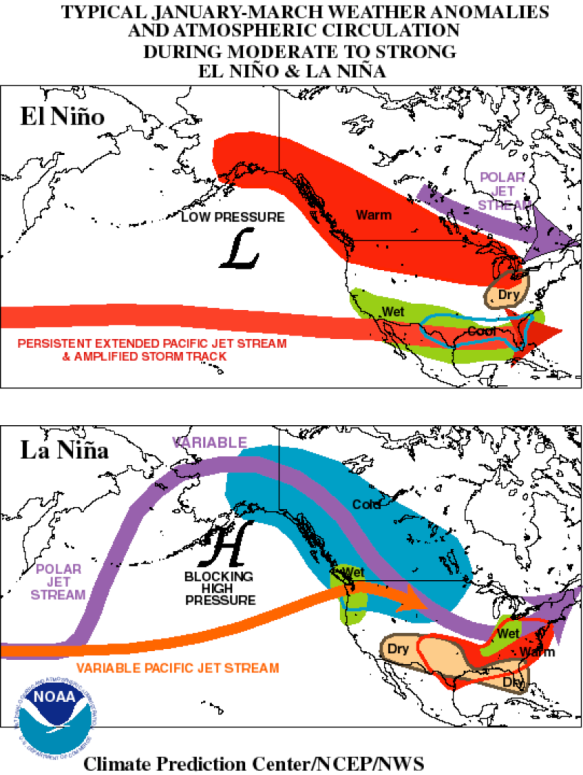
If we take a look at atmospheric conditions for North America, we can see that El Nino and La Nina tend to alter prevailing wind patterns, which in turn influence the weather that the continent experiences when either “the boy” or “the girl” is in control.  The NOAA graphic below shows that during an El Nino pattern, the jet stream is deflected equatorward, and low pressure develops over the northern Pacific Ocean.  This leads to warmer than normal winter conditions across the continent, and wetter conditions across the southern tier of states.

When a La Nina develops, it tends to enhance the polar jet stream and leads to the development of a strong regional ridge of high pressure over the Pacific Ocean.  This ridge of pressure tends to funnel storm systems into the northwest corner of the United States’ west coast as well as further north into British Columbia and the Yukon Territory in Canada and also into Alaska.  Typically, this means wetter than normal conditions in the Pacific Northwest and Western Canada, and drier than normal conditions across the southern tier of states in the US.

Different patterns of temperature and precipitation occur on the different continents around the world during either an El Nino or La Nina.  Each time, the strength and intensity of their effects on winds, temperature, and precipitation vary.  The geographic positions of these effects also varies; one location may be flooded and swamped during a La Nina event and several years later may experience little rainfall at all during the next La Nina event.  An important thing to remember about El Nino and La Nina events is that they are each a shift in the climate pattern for the entire planet.  Each only lasts about a year on average, but nonetheless, each is a significant shift in climate that helps bring about very significant changes in weather patterns that influence the day-to-day experiences of people everywhere on the planet.

Ppvvvtt! Zzzzzzzzzzzzzzzzzzzz!

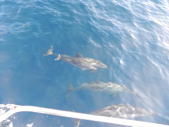
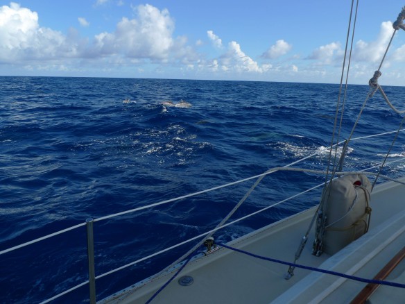
Ppvvvt zzzzzz?  That’s the sound that the fishing line makes when we get a bight or catch a fish.  We had all settled into the heat of the mid afternoon reading, chores, maybe a nap.  This sound got our attention, and we slowed the boat to reel the fishing line in.  it turned out that whatever it was came off, but we then saw that there were dozens and dozens of dolphins riding along with us.

The whole group raced alongside the boat, leaping out of the water, crossing over in front of the bow and generally appearing pretty playful with each other.  Every so often, a sheet of flying fish would rise up out of the water- maybe 100 of them- and try to escape the dolphins.

The camera doesn’t do it justice, but when I stood on the bow of the boat I could look down on top of them as they swam underwater, got ready to beach, and then dive in again.  A beautiful thing to see, easy to see why these are among the more charismatic images we have of ocean wildlife.  When they came up out of the water, you could hear them clearly breath in air after blowing water out.

Here you can see what a squall on the radar looks like- not much different than a video game- you don’t want the bad blob to get to close to you.  Seriously, though, it gives us good directional and intensity information about these powerful and sometimes dangerous storm cells.

Trail Report Information

Barometer 1006

Cloud 67F  20%

Humidity 82%

Air temp 86F

Boat speed 5.3 knots @ 225 heading

Wind 14 knots, E

Water temp 81

Plankton count 1/64th mL

S 6 25.27

W 137 30.00

Climate: The Two Ports

What is the climate of Cabo San Lucas and that of Nuku Hiva?

We can examine the concept of climate by examining average temperature and precipitation conditions at Cabo San Lucas, Mexico (port of origin) and also at Nuku Hiva, French Polynesia (port of destination).  The numerical data were collected from and crosschecked by information from several on-line climatic data repositories.  We will examine the numerical data, graphs of climate data (climographs), and explore the geographic settings of each location that help explain the graphed numbers.

Climate and Geography of Cabo San Lucas, Mexico

Climate Data for Cabo San Lucas
Avg. Temp (F)

64

66

68.5

72

75

80

84.5

85

84.5

79

73

67.5

Precip (in)

0.2

1.1

0

0

0

0.2

0.4

1.2

1.4

0.6

0.5

1.1

Month

J

F

M

A

M

J

J

A

S

O

N

D

Cabo San Lucas is located on the southern tip of the Baja Peninsula, on the Pacific coast of Mexico.  This coastal area is dominated throughout the year by a cold current flowing south along the margin of the Pacific, combined with cold, upwelling water along the peninsula; both currents are influenced by the westerly wind belt.  Although it is warm in the air, the cool water means less evaporation occurs than people might expect in a coastal location.  In the spring, as the sun migrates north toward the Tropic of Cancer, the drying effects of the subtropical high pressure belt also migrate north; notice that precipitation does not occur in the spring months.  Precipitation picks up in the summer months as local winds undergo a reversal, or monsoon, and flow onshore.  This reversal of wind brings warm, moist, tropical air from the south into the region.  These southerly winds flow up the mountains that lie to the north of Cabo San Lucas, lifting the moist air and enhancing rainfall.  This is known as orographic lifting and orographic precipitation (mountain lifting and precipitation), which works much in the same way as air flowing across the mountains of the coastal Pacific Northwest in the United States.  There is a warm season that occurs following the high-sun June solstice and a cool season that occurs following the low-sun December solstice.

These average conditions of temperature and precipitation place Cabo San Lucas in a general climate category of tropical desert, with an average surface temperature of 75 degrees Fahrenheit and total annual precipitation of 6.7 inches.

Climate and Geography of Nuku Hiva, French Polynesia

Climate Data for Nuku Hiva
Avg. Temp (F)

81.5

81.5

81.5

81.5

80.5

80.5

78.5

78.5

78.5

79.5

80.5

81.5

Precip (in)

5

4

6

5

5

6

5

4

2

3

3

4

Month

J

F

M

A

M

J

J

A

S

O

N

Nuku Hiva is a volcanic island in French Polynesia (also known as the Marquesas Islands).  The weather station is located at the airport on the northwestern corner of the island.  Nuku Hiva’s location nearer to the Equator, and being an island surrounded by ocean, contributes to its near-constant average temperature.  The weather station receives rainfall throughout the year which supports lush grasses and tropical trees.  The weather station receives less rainfall than it could, because it is in the rainshadow zone of a mountain ridge (of Mont Tekao) that intercepts the prevailing winds and causes mountain uplift and precipitation to the southeast of the weather station.  Up the slopes of the mountain there is more rainfall and the terrain more closely resembles that of a tropical rainforest than a tropical grassland; the mountain causes rain to fall out of the rising air, and as the air descends the northwestern slopes of the ridges towards the airport’s weather station, it dries out a bit and has less rain to drop on the airport.  Even so, it receives more annual rainfall than Seattle, Washington.

At the weather station found at the airport, the average temperature is 80 degrees Fahrenheit and the total annual precipitation is about 52 inches.  The general climate for the island is tropical, but the landscape position determines whether grasses or trees dominate.  If a landscape is found on the windward side of a mountain, it gets more rainfall; if it is on the leeward side of a mountain, it gets less rainfall.

Motoring…

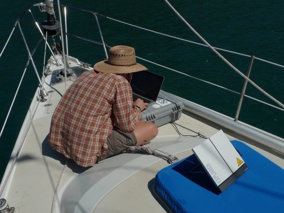
Another good day of mileage- as we draw nearer we are less stingy with the use of our motor.  When the boat speed drops to around 3 knots, we think about switching it on.  This also has the benefit of generating electricity- charging batteries, powering radio communication equipment and laptops.

Swimming today included some barnacle scraping- the goosenecks are persistent!  Also, Mark and I were stung by small jellies.  Just little welts, but the first time we had seen that on the trip.  We could also feel hot and cold water exchanging near the surface- cool rushes of water followed by the water regaining the surface temperature of about 81 degrees.

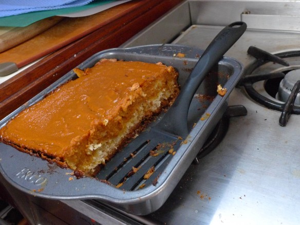
Food remains good, Joseph made a Pumpkin pie today!  We debated this for a few days, but decided as long as the oven was running when it was ‘cooler’ outside, it would not overheat us in the cabin.  Thanks for the pie Joseph!

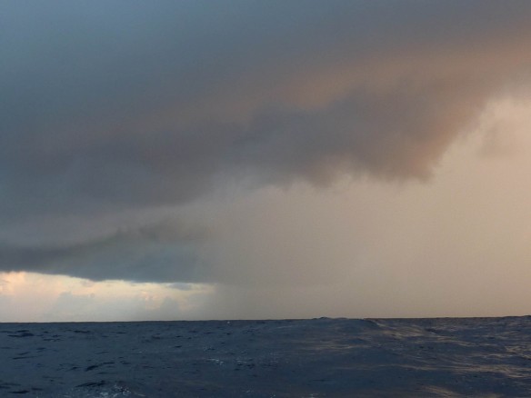
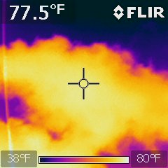
Again, we are seeing great night watches.  The sky is great and we get to see storm cells – or squalls – develop.  These are actually quite a concern.  They only really happen at night, last nights big one was on my watch at 3:30am.  We heard on the radio that another boat had their sail damaged and disabled in one of these earlier this week.  While we are close to our destination, we are no means out of danger yet.

Trail Report Information

Barometer 1010

Cloud 77F  20%

Humidity 76%

Air temp 89F

Boat speed 6.3 knots @ 223 heading

Wind 10 knots, SE

Water temp 83.5

Plankton count 1/64th mL

S 04 38.38

W135 50.14

Climate: General Notes

What is climate, anyway?

This is actually a harder question to answer (especially in brief) than it first appears.  Concepts related to climate have become highly politically charged in recent years, and just about every week there are stories in the print and broadcast media about how climate might be undergoing significant changes.  Before we can talk about climate change, we need to have a basic understanding of what climate is, especially from a scientific perspective.

In earlier entries, we have explored concepts of solar radiation, large circulations in the atmosphere, continental and maritime effects on temperature, precipitation patterns, and winds.  All of these features of our planet (and some other important ones) contribute to the average temperature and precipitation conditions that a region or a location experiences over time.  Weather stations around the planet record information about temperature, precipitation, air pressure, wind direction, wind speed, cloud cover, and other atmospheric variables.  These observations are collected, processed, analyzed, and shared with the global scientific community.  A wide variety of scientists and professionals use these data to understand average climatic conditions (climatology) and to provide context for weather conditions (meteorology).

Scientists who study climate prefer to have at least 30 years of information to analyze when analyzing the climate of a location or a region, and preferably much more than 30 years.  Average conditions can be computed for weather station observations at many different time scales: daily, weekly, monthly, yearly, or by decade or century.  Climate information can come from direct observations, like those from weather stations or from airplanes and ocean vessels taking observations while they are traveling from one location to another.  Climate information can also come from proxy sources of information, such as tree ring analysis (dendrochronology), plant and fossil animal remains (paleoecology and paleontology), layers of sediment containing plant pollen in lake bottoms (stratigraphy and palynology), ice cores from alpine or continental glaciers (glaciology), and other environmental indicators of temperature and precipitation patterns over time.

One of the ways to visualize “climate” is to look at a global map of climate types.  On the map of North and South America included below, the Koppen climate classification system has been applied to the world, and what is shown are the major elements contributing to climate regions and the spatial extent of the major climate types.  Depicted using colored lines and different typefaces for map symbols are the locations for warm and cool ocean currents, the location of the Intertropical Convergence Zone for July and January, relatively consistent locations for air pressure regions, and source regions for large, regional air masses.

Notice that similar conditions tend to produce similar climate types in different regions.  On the west of North America, a cool coastal current in the middle latitudes combined with westerly winds and mountainous terrain produce a climate type known as “Marine west coast”.  The type of land cover found here is like that on the coast of Oregon and Washington, being a temperate rainforest.  Similar climatic inputs and terrain are found on the tip of South America, producing another region of classified as the same climate type.

Home stretch

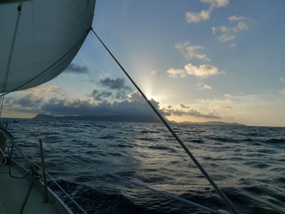
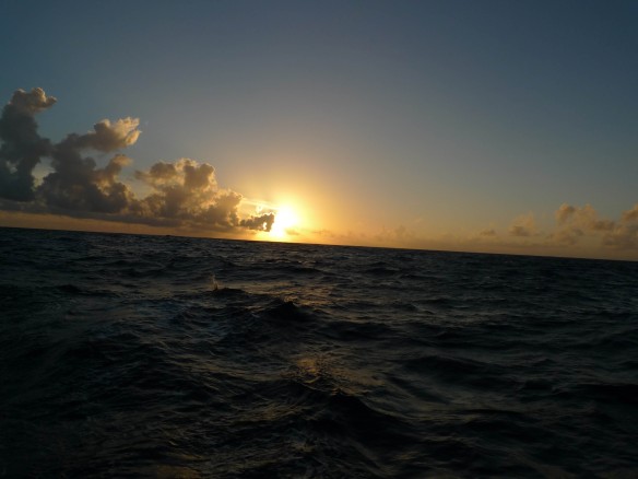
Well, now we are in it!  It is very hot and humid during the days, a significantly different ride than the last few weeks have been.  Good thing we can swim.  In the mid-day heat that’s what does the trick- takes the edge off the heat and as the rest of the day gets cooler we ease into nighttime more comfortably. Here are a couple photos I took during my evening watches. The first at the beginning of the night during my first watch and the second during the last watch of the night.

Its amazing how my mind has gotten used to my little space- the boat’s cockpit, galley, and main cabin.  I am really used to a larger domain – as I am sure all of you are- throughout the day that includes indoor and outdoor spaces as well as a variety of people.  I think I am past the acclimation phase on this aspect of the sailing trip- probably a shock to be home in Idaho later in the month.  Another aspect of getting used to this very small space is made clearly evident when we swim.  I will take some strokes out away from the boat and look back at the ship- bobbing along with no crew.   Its immediately clear to me with no long distance between that ship and I just how insignificant we both are in the sea!  A relevant reality check.  Being on the boat is a real paradox of space- feels small when you are on it, but when you are away it feels smaller still.

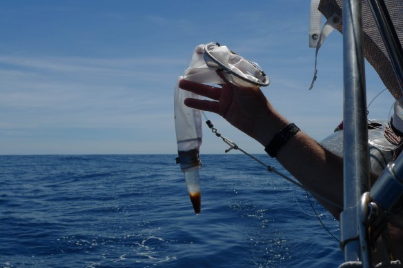
We did a plankton sample today- wow!  A significant increase!  Maybe you have some guesses as to why?  Hopefully this means, among other things, better fishing!

We continue to eat well too!

Trail Report Information

Barometer  1010

Water temp 81F

Air temp 89 F

Cloud temp 52 and 15% cover

Plankton 8mL!!!!  2nd test- 1/32 mL

Speed/bearing 6 knots at 222 degrees

Wind/direction 2 knots, SE

Humidity 72%

Winds: Sailing and Wind Power

How does a sailboat harness the wind for movement?

The reference image above shows some of the essential parts of a sailboat.  The hull is the main body of the sailboat, to which everything else is attached.  The two masts rise up over the hull, carrying the sails aloft when the crew deploys them.  Sails are wrapped and stored on the booms when not in use.  When the sails are deployed, the rigging lines and pulleys are used to set them aloft and adjust them as needed when winds change.  The rudder is used to steer the sailboat.  Unseen below the sailboat is the keel, which steadies the boat while it is at sea, helping to prevent the sailboat from overturning in strong winds.

With a following wind, a wind coming from behind the sailboat, the boat can make forward progress.  The wind flows over both sides of the sail, the convex outer side that faces toward the front (bow) of the sailboat and the concave inner side that faces toward the back (stern) of the sailboat.  The air flowing across the stern side of the sails travels a shorter path down the inside of the sails, and the air molecules are more tightly packed together.  On the bow side of the sails, the air molecules spread out and have to move faster to flow across the relatively longer sail surface.  This creates an area of relatively higher pressure behind the sail and lower pressure ahead of the sail.  The imbalance in pressure creates a forward-moving force that causes the sailboat to move.

So long as the sailboat deploys enough sail to capture the force of the wind, and remains oriented so that the following wind fills the sails, forward motion is possible as long as the wind persists.  The diagram below shows the different orientations that a sailboat can take with respect to the wind and still make forward progress.  “Tacking” is when the sailboat makes a turn into the wind.  On a starboard tack, the starboard (right-hand) side of the sailboat is pointed toward the following wind, but the sails can still be inflated and forward motion occurs.  On a port tack, the port (left-hand) side of the sailboat is pointed toward the following wind.  Tacking is important when sailing close to shore, such as between two islands that are close together, or to avoid potentially dangerous objects floating in the water (such as a log or marker buoy).