Training complete!

Training Complete!

This slideshow requires JavaScript.

Wrapping up the final thoughts, ideas and plans for the adventure coming up, Joseph and I went though a few more lists before I left the San Jauns.  One of the important things we checked out was the operation of the BGAN terminal at sea.  We successfully sent 2 messages from the boat- while traveling around 5 knots.

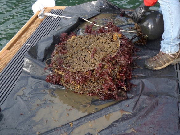
Down at the dock we enjoyed some marine science on the dock, looking at the catch from a marine survey net that they keep at the camp.  We examined sea urchin, sea slugs, sea squirts, shrimp, decorator crab and more.  The decorator crab is so named because it takes algae and attaches it to its legs and body in order to have the best ‘place-based’ camouflage.  Way cool!

In addition to Canoe Island French Camp offering great summer experiences through French language, many opportunities exist to go to the island and explore marine science.  Check out more about this great location at  http://www.canoeisland.org/ .  Canoe Island French Camp is one of the country’s premier French residential camps, located near Seattle, Vancouver BC, and Victoria BC. Children, ages 9-16, take part in a unique mix of French language and culture through artistic and outdoor activities. Fencing, archery, sailing, kayaking, swimming, photography, marine biology, and French culture, cuisine and language classes are options every day.

This week I will have a conference call/ video chat with the teachers in the ICE Net project to talk about sailing trip.  I will post their thoughts and questions here later in the week.

Finally, in other updates the online MATRIX of climate concepts is soon to launch and you will be able to find the University of Idaho AL@ homepage up soon!

Prepare to Jibe! Jibe ho!

Prepare to Jibe!

This slideshow requires JavaScript.

The sailing conditions where intermittent the first day of our trip, but the second day- just as we thought we would have little to sail- the wind picked up quite a bit and we make some great headway.  Along the way we saw bald eagles, grebes, and cormorants in addition to the otter and seal here and there.  We sailed along the US/Canadian boarder for a good stretch and enjoyed a pleasant and still night at a protected moorage.  All of this reminded me of living in the islands in Southeast Alaska- cool, wet, misty, rocky coast and forested islands; a great feeling.

On the first day we heard on the radio a report of an airplane door that had washed ashore on John’s Island.  Monitoring the radio conversation with the US Coast Guard, we changed course to head in the direction of the report.  The Coast Guard helicopters began to fly overhead and they called on any vessels in the area to offer information and support for an active search.  We radioed in, and told them where we were and our course.  After scanning the coast line for a few hours, more information came across the radio from the Coast Guard and some residents of the island.  It turned out to be old wreckage from an airplane- not a recent one- and the search was called off.  It served as a reminder of how vulnerable things can be on the ocean and in the islands; but it also provided us something to turn our attention towards in the constant rain.

Finally, towards the end of the sailing, I tore a hole in the head sail in strong wind.  This required us to moor, and have to replace the sail in the wind.  This was quite the training experience indeed!  As I lay on the bow of the boat in the wind, holding the sail down as Joseph lowered it from the helm, I thought to myself ‘I wished I weighed 600 pounds!’ as the wind was pulling me off the deck.

Some vocabulary and skills were covered- I appreciated the lessons and they will surely help our trip go smoothly next month.  Joseph is an experienced sailor and teacher- it was a great experience.  Back on the island and after a great dinner, Joseph, Connie and I went over the trip; lessons learned vocabulary and considerations for the trip ahead where discussed.

Back stay- cable, Fore stay- cable, Shroud – port and starboard, Chain plates, Spreader, Spreader boot, Wind vane, Indicators, Tack, Ready about!, Wheel, Tiller, Helm’s a lee, Prepare to jibe, Port, Starboard, Bow,  Stern, Steers head, Jiffy reef, Halyard, and Sheets to name a few!

Taking a ship to Orcas, a boat to Canoe, and then….the Triska

Taking a ship to Orcas, a boat to Canoe, and then….the Triska


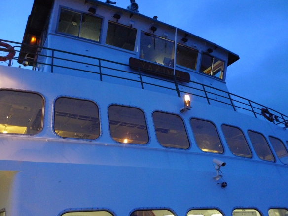
Getting out to meet Joseph on Canoe Island was no short task.  I drove all day to the San Juan Islands in Northwest Washington state- nearly 400 miles.  From there, I caught the ferry- M/V Yakima – to travel from Anacortes to Orcas Island.  I missed the 3:20p sailing by a few minutes, which gave me the opportunity to shop in town for the upcoming sailing.  The ferry took about an hour, and as my oldest memories of the Washington coast often remind me, there is a great feeling in any journey that involves travel on a ship.  Having been in the truck all day, this gave me a chance to get out, walk around and take in the new sights, smells, and sounds of the coast.

Once on Orcas Island, I parked and unloaded the truck and met Joseph for the short boat ride to Canoe Island.  About 25 minutes later our runabout came into harbor at Canoe Island.  This is a private island, home to Canoe Island French Camp which Joseph and his wife Connie run.

Joseph and I intend on this trip orienting me to some sailing skills and testing out the satellite communications system we will use to support this website.  Joseph’s boat, the Triska, is a 29 foot sailboat.

Preparation and Planning: Skype with the S/V Southern Cross

This slideshow requires JavaScript.

Preparation and Planning: Skype with the S/V Southern Cross

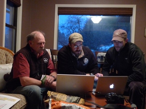
We Skyped with the S/V Southern Cross recently to sort out logistics and to discuss some equipment considerations for the boat as well as the crew.   From Joseph’s farm in Idaho, team members Joseph, Justin, Brant, and Mead connected with Viki and Mark down in Mexico via skype.  We introduced some of the expedition equipment and communications systems, including the BGAN and solar panel.  Some speculation is rising about the effectiveness of the BGAN at sea- traveling 6 knots with ocean swells.  We will test this on the San Juan sailing trip coming up.  Also, Mark will post this question around so that other ‘cruisers’ can comment.

We covered some food and medical lists, sailing safety equipment, and the logistics of posting the education material onto the site from sea.

Coming out of this meeting, excitement is building for this trip!  Check out Mark’s new bio on the Expedition Team link, and look here for updates on the sailing trip from the San Juan Islands shortly.

What questions do you have about this journey?

What would you like to see on the site?

Have you traveled at sea and have advice?  Post a comment and help this trip along!

AL@Latitude: Equator

AL@ Latitude: Equator

On March 21, 2012 Justin Hougham, Joseph Jones, and Mark Reed will sail out of Cabo San Lucus, Baja headed for Nuku Hiva in French Polynesia where they’ll be making landfall on about April 12th. Through a satellite connection to Education Basecamp based in Moscow, ID headed up by Brant Miller, there will be daily uplinks to the expedition website for science classes regarding the natural and cultural history of the Pacific via an Iridium SAT phone and BGAN.  Classes that follow the trip across the Pacific will find value in tracking a variety of physical and biological ocean and atmospheric conditions: wildlife sightings of all types, air temperature, water and air clarity, particulates, wind speeds and directions, ocean currents, sea state (swell and wind waves), clarity, color, plankton counts and variety (day/night variations, plus latitudinal/location changes) etc..  The boat is a very solid and seaworthy 37’ Erickson sailboat, and the dates of the trip across are timed for optimal weather conditions. About 50 boats make the crossing each year, with usually about 47 of them never running into any heavy weather at all on the crossing. All standard open ocean safety gear will, of course, be on board (harnesses for use whenever on deck solo/night/rough weather, lit man-over board-pole, rough weather sea anchor, open ocean survival raft, GPS-linked EPIRB, etc.).

This journey will kick off a series of expeditions focused on climate change across the world, directly looking at climate data from Northern Hemisphere latitudes and connecting with classrooms investigating the same ideas.  This will provide invaluable cause and content for NASA ICE Net Teachers to follow an expedition, take measurements in their classrooms, and start their own Adventure Learning journey connected to the MATRIX of climate science principles. We expect that this will inspire students to engage in science and to ask the question, “Where will you AL@?”

The development site for this project can be found here: https://alatlatequator.wordpress.com/ and the full site launch will be March 1, 2012.  An example of a completed expedition can be found here- http://alatuimainsalmon.wordpress.com/ and includes many examples of the excitement that this approach elicits from students, teachers, and community members.

What information contributes to our understanding of climate?

How is our world changing?

How do you experience the world around you?

How do you observe and reflect on the world around you?

How do you connect to your local place?

How do you connect from your place to the world?

Look for weekly updates in the next month, and, as the expedition launch draws nearer, I will begin more frequent posts concerning the climate science, the logistics and details of sailing, and information that partner schools post (questions, observations, data).

Where will you AL@?